Maps and the 20th century: drawing the line
by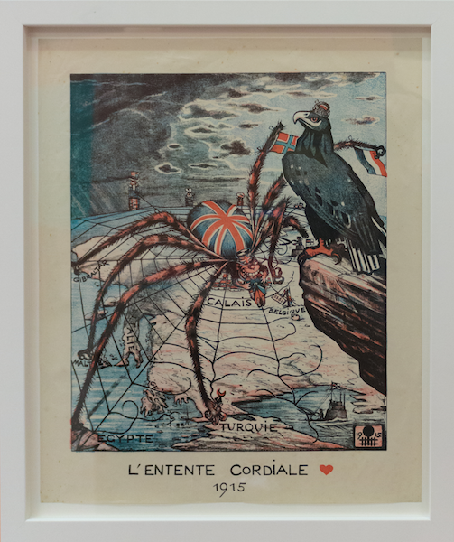
German propaganda poster for French citizens, 1915 © Jon Ellis/The British Library
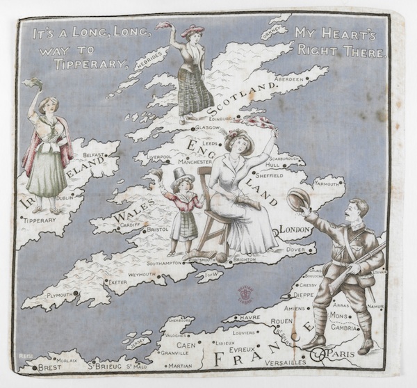
World War I printed handkerchief © The British Library
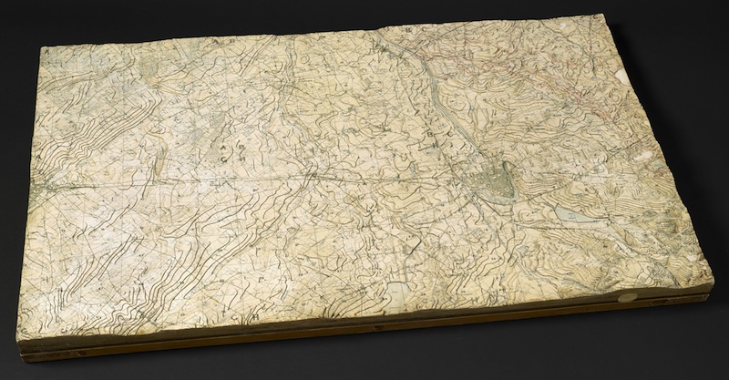
Western Front trench model, 1917 © The British Library
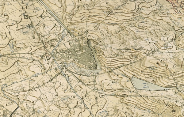
Western Front trench model, 1917 (detail) © The British Library

American propaganda poster with the German captal at its centre, 1943 © The British Library
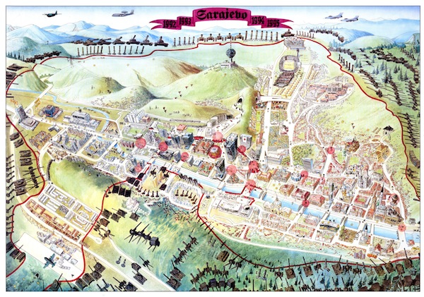
Escape routes out of Sarajevo, 1996 © Miran Norderland
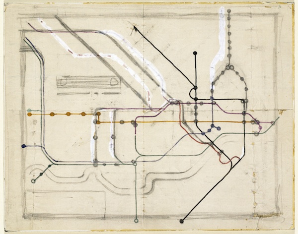
Harry Beck’s original sketch for the London Tube map, 1931 © Victoria & Albert Museum/TfL

Watercolour map of Africa by H.T. Hawes for the Philips Atlas, 1957 © The British Library/Philips Business Archive
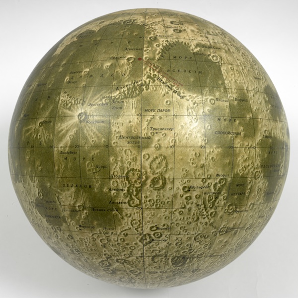
Russian moon globe, 1962, based on data from the 1959 Luna 3 mission © The British Library
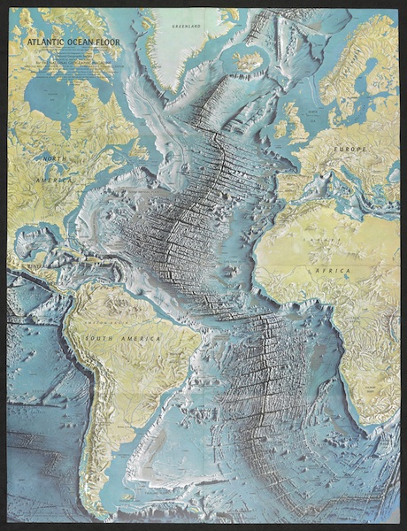
Atlantic Ocean floor by Heinrich Berann, June 1968 © National Geographic

Earthrise photograph taken by Apollo 8 astronaut William Anders on 24 December 1968 © NASA
From questions of war and peace to understanding the movements of people, nature and even the financial markets, the new exhibition at the British Library, Maps and the 20th Century: Drawing the Line, explores how maps have become increasingly present in daily life. The exhibition looks at the spectacular advances in the technology of mapping across the century, from the land surveys of 1900 to the development of satellite imagery by 2000. For the first time, we could see from the Atlantic Ocean floor to the far side of the moon.
Maps intrigue and astonish us, and the exhibition gives a captivating and sometimes unexpected take on our recent past. Maps always reflect the motivations of their creators, and we examine how maps were used not only as sources of information, but as tools of power and influence. There are maps from literature too, including Tolkien’s annotated ink sketch of Middle Earth and E.H. Shepard’s original drawing of Hundred Acre Wood for the 1926 edition of Winnie-the-Pooh.
Click on any image to enlarge and view
as slideshow
The exhibition is accompanied by a season of events exploring how maps continue to shape and influence the world we live in, exploring themes of fictional maps, political propaganda and transport. Highlights include:
Thursday 10 November
Fantastic Maps: From Winnie-the-Pooh to Game of Thrones
In this celebration of fictional maps, writer and broadcaster Brian Sibley explores some of the classic maps of fictional landscapes and publisher David Brawn looks at the worlds created by Tolkien and C.S. Lewis. They are also joined by cartographer and artist Jonathan Roberts, creator of the official maps of Westeros and Essos from George R.R. Martin’s A Song of Ice and Fire.
Tuesday 15 November
Great Escapes: Mapping War from WWII to Sarajevo
Former BBC correspondent Kate Adie hosts the evening with speakers including Barbara Bond, who reveals the extraordinary world of the silk escape maps smuggled by MI9 into WWII prisons, and Miran Norderland, who has led the documentation of the 1990s siege of Sarajevo through powerful maps and other media.
Tuesday 29 November
Global Conquest: How Railways Took Over the World
In 1830, the world’s first railway opened between Liverpool and Manchester. By the end of the century, there were 200,000 miles of track across the world, and this continued unabated into the 20th century, with the world’s longest, the Trans-Siberian, completed in 1916. By the time Harry Beck produced his influential London Underground map in 1933, cities and whole countries had been reshaped by the possibilities of mass transit. Author, commentator and railway historian Christian Wolmar charts how the iron road spread so rapidly and extensively.
Tom Harper is a curator of antiquarian mapping at the British Library and lead curator of Maps and the 20th Century: Drawing the Line, for which he edited the accompanying book. He co-curated (with Peter Barber) the 2010 exhibition Magnificent Maps: Power, Propaganda and Art, and (with Philip Hatfield) Lines in the Ice: Seeking the Northwest Passage in 2014–15.
Maps and the 20th Century: Drawing the Line
4 November 2016 to 1 March 2017
British Library, 96 Euston Road, London NW1 2DB
£12/various concessions
Members and under-18s FREE
Open daily
Monday, Wednesday, Thursday and Friday 9:30 to 6 pm
Tuesday 9:30 to 8 pm
Saturday 9:30 am to 5 pm
Sunday 11 am to 5 pm
More info


