A skirmish between Martin Frobisher's men and Greenland Inuit at 'Bloudie Point' on Frobisher's second voyage in 1577. London, 1578‘A map of the North Pole and parts adjoining’ by Moses Pitt, from <em>The English Atlas</em> – the personal atlas of King Charles II. London, 1680″ src=”https://bookanista.com/wp-content/uploads/2014/11/Map_420.jpg” width=”420″ height=”344″></a></p>
<p><a href=Illustration from <em>A Voyage of Discovery… Inquiring into the Probability of a North-West Passage</em> by John Ross. London, 1819″ src=”https://bookanista.com/wp-content/uploads/2014/11/Bear_420.jpg” width=”420″ height=”320″></a><a href=Engraving by Edward Finden after a drawing by George Back, from John Franklin’s <em>Narrative of a Journey to the Shores of the Polar Sea, in the Years 1819, 20, 21, and 22</em>. London, 1823″ src=”https://bookanista.com/wp-content/uploads/2014/11/Forest_420.jpg” width=”420″ height=”280″></a><a href=A game of cricket played on the ice. William Edward Parry, <em>Journal of a Second Voyage for the Discovery of a North-West Passage</em>. London, 1824″ src=”https://bookanista.com/wp-content/uploads/2014/11/Cricket_420.jpg” width=”420″ height=”313″></a> <a href=<em>Boat-Cloak or Cloak-Boat</em> by Peter Halkett, 1848. An early inflatable dinghy, developed in London and tested on the River Thames, that doubled as a cloak (with a sail that doubled as an umbrella)” src=”https://bookanista.com/wp-content/uploads/2014/11/Cloak-Boat_420.jpg” width=”420″ height=”315″></a><a href=<em>HMS Assistance and Pioneer in Winter Quarters, Returning Daylight</em>. From a series of fourteen lithographs based on sketches made by Commander Walter W. May during the voyage of <em>Assistance</em> up Wellington Channel in search of Sir John Franklin. London, 1855″ src=”https://bookanista.com/wp-content/uploads/2014/11/Returning_Daylight_420.jpg” width=”420″ height=”301″></a><a href=Artefacts found on the search for Franklin and his crew, Walter William May. London, 1855Illustration from <em>Kaladlit Oklluktualliait</em>, woodcuts of traditional Greenlandic Inuit stories by an indigenous artist. Godthaab, 1859–63″ src=”https://bookanista.com/wp-content/uploads/2014/11/Woodcut_420.jpg” width=”420″ height=”248″></a><a href=Cape Prescott, 8 August 1875. Photograph taken during the British Arctic Expedition of 1875–76An early illustration of Santa Claus as we now picture him from Thomas Nast’s <em>Christmas Drawings for the Human Race</em>. London (New York), 1890″ src=”https://bookanista.com/wp-content/uploads/2014/11/Father_Christmas_420.jpg” width=”420″ height=”586″></a>Just a matter of weeks after the long-anticipated discovery of Sir John Franklin’s lost ship HMS <i>Erebus</i>, the British Library looks back on 400 years of fascination with the fabled Northwest Passage.</p>
<p>From Charles II’s lavish personal atlas to 19th-century woodcut illustrations and wooden maps crafted by Inuit communities, <i>Lines in the Ice</i> features material from Europe, Canada and the Arctic, much of it on display for the first time, to provide absorbing insights into the mysterious region.</p>
<p>This small but remarkable exhibition, curated by Philip Hatfield and Tom Harper, focuses on three of the most eminent Arctic explorers to seek the Northwest Passage: 16th-century seaman Martin Frobisher, who misguidedly extracted and shipped vast quantities of iron pyrite (‘fool’s gold’) back to the Britain; acclaimed Victorian explorer Sir John Franklin; and Roald Amundsen who, as well as being the first man to the South Pole, was a member of the first crew to fly across the Arctic.</p>
<p style=Click on any image to enlarge
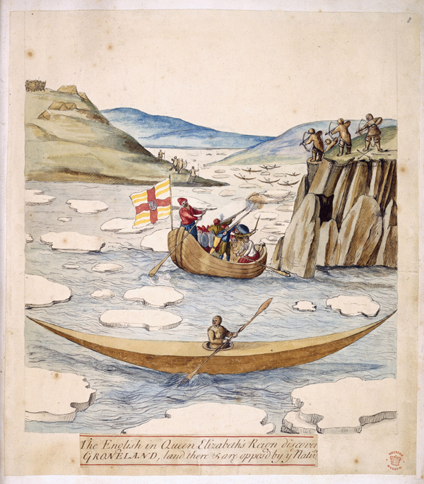
and view as slideshow

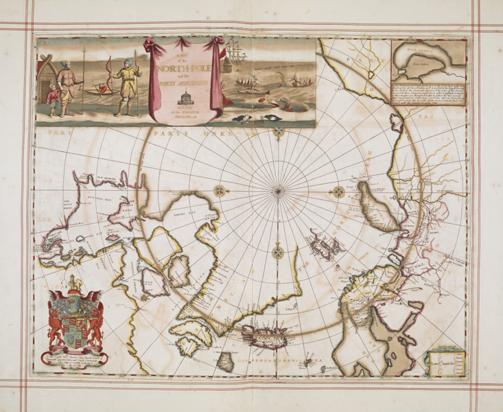
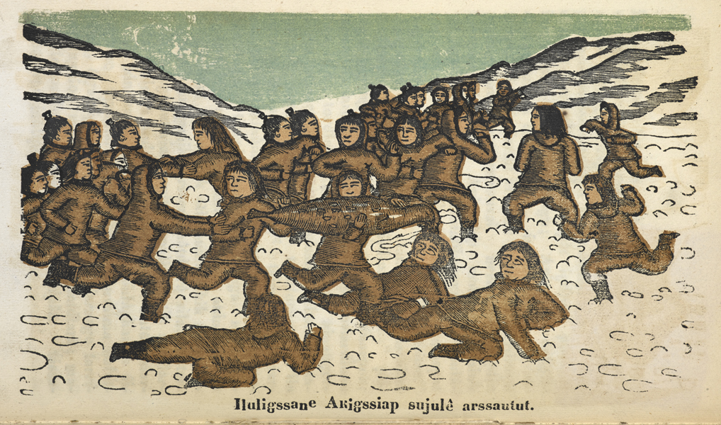
Their stories are told via first-hand accounts of life and conditions in the Arctic, ancient and modern maps showing our changing perceptions of the Northwest Passage, rare oral recordings of Inuit describing the arrival of European explorers, and video footage of a failed attempt to fly across the Arctic.

During the course of the exhibition, the Library’s writer-in-residence Rob Sherman is writing an interactive story and game, funded by CreativeWorks London. See his work unfold on his blog diary.

A series of events about the Arctic is headlined by Ryan Harris, a marine archaeologist who was part of the successful search for HMS Erebus, and includes a talk by Rob Sherman and a debate on science in extreme climates. More info.


Lines in the Ice: Seeking the Northwest Passage runs from 14 November 2014 to 29 March 2015. The exhibition is sponsored by The Eccles Centre for American Studies and One Ocean Expeditions.

Opening hours
Monday to Thursday 9:30 am to 8 pm
Friday 9:30 am to 6 pm
Saturday 9:30 am to 5 pm
Sunday and Bank Holidays 11 am to 5 pm
Free entry


Philip Hatfield is Curator for Canadian and Caribbean Studies at the British Library and the lead curator of Lines in the IceTom Harper is a curator in the British Library’s Department of Cartographic and Topographical Materials, co-curator of the exhibition, and co-author of Magnificent Maps (2010) and A History of the 20th Century in 100 Maps (2014). More info.


All images courtesy of The British Library